
We are sorry, there are no reviews yet for this tour.
Mountains and Exquisite Communities (15 Days)
Adventure Trekking:
Putao – Ziyadum – Namro – Mansakun – Pansat – Nomung – Putao
A Journey through Mysterious Landscape, Diversification of Culture and unique life Style!
It’s a combination of a trek that takes you to the tropical river valley, along the hunting trails through pristine forest and isolated settlements. The trail often goes winding through high witness different species of orchid along with birds. The Noiwinlit and Babulonhtan valley is the depot of botany in northern Myanmar having a huge range of flowers.
Day 01: Arrival – Putao
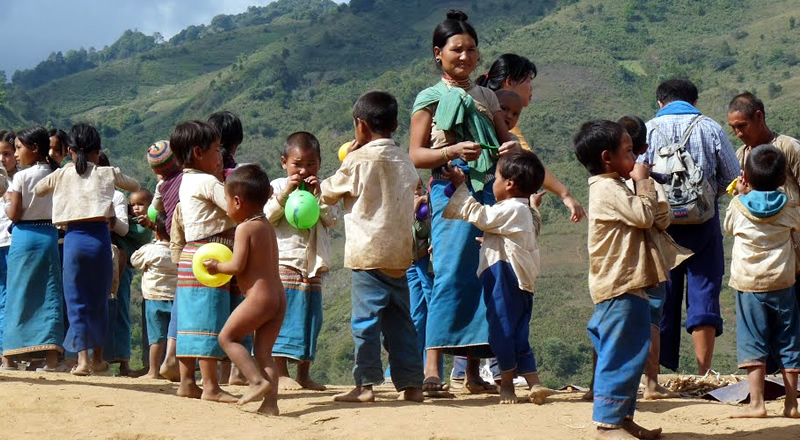
Upon arrival at Putao airport we will be met by our representative and transferred to our lodge. Putao lies in a valley, jumping-off point for trekkers who want to explore the region’s deep forests, wildlife sanctuaries and snow-capped mountains etc. After a brief fresh up take a walk around Putao for the orientation. Dinner and overnight at Putao Lodge.
Day 02 : Putao – Shangaung – Wasandum
(elevation 1450 feet to 4600 feet, then to 2844 feet)
Early in the morning we visit attractive Putao market often fills with colorful ethnic minorities. Later we depart by jeep to upper Shangaung, 10½ mile through the valley across several smaller villages and open fields. Our adventure starts as we get off the jeep and start trek to Wasandum, located at 2844 feet above sea. This is consider a challenging trek as not only it goes toward the shoulder of Mt, Shangaung at 4606 feet (14½ mile, approx. 7 hour). First 6 mile will be straight up along the trail winding up to the top of Mt. Shangaung from then trail goes all the way down to Wasandum located at the Valley of Namro River. Though the trek itself is challenging but we enjoy the trek goes deep in to primary forests where we see many birds and heard sounds of monkeys in the near distance. Wasandum is a small Rawan tribe village situates by Namro creek. Dinner and overnight at Wasandum guest house.
Day 03: Wasandum – Awadum – Ziyadum
(elevation 2844 feet to 3540 feet)
Breakfast and we trek to our today destination at Ziyadum, located at 3540 feet above sea. At first we cross Namro creek to Awadum (1) (3 mile, approx. 2 hour). Awadum is mainly inhabited by Lisu and separate in to two by a large paddy field. From here we walk pass vast paddy field to Awadum (2) (1½ mile, approx. one hour). From here the trail goes through lush evergreen forests and enjoyable scenery towards Ziyadum (5.40 mile, approx. 3 hour). Ziyadum is the most northwestern and last frontier village in Putao region, mainly resident are Rawan tribes. After a brief fresh up we visit Ziya creek for a fantastic sunset view with a blazing snow Mountains in the west which spark in to steady flowing Ziya creek. Dinner and overnight at Ziyadum guest house.
Day 04: Ziyadum – Wasandum
We have a lazy morning to enjoy the site and sounds of this frontier environment. After early lunch we bid farewell to the locals and head back to Wasandum. Here we took a different route which goes through Kalang (4 mile, approx. 2 hour) through primary forests and cross Phangran creek with suspension bridge. After Kalang we again had to cross another suspension bridge which span Namlang (Mula) river to Awadum (1) (6.8 mile, approx. 3 hour). We have lunch at this village and later trek back to our Wasandum guest house (3 mile, approx. 1½ hour) for the night. Dinner and overnight at Wasandum guest house.
Day 05: Wasandum – Namro – Kagyi Mountain
(elevation 2844 feet to 4820 feet)
Breakfast and we walk along Namro creek through the open paddy field to Namro, located at 2820 feet above sea (2.5 mile, approx. one hour). Our adventure starts at here as we start cross Namro creek to get in to a lush tropical rain forest fill with large trees, vine, creeps and occasional bamboo grove. Trek goes pretty flat cross creek and island until we reach at the bottom of the Kagyi Mountain (4½ mile, approx. 3 hour). From here a challenging trail goes straight up to the shoulder of Mt. Kagyi at 4280 feet above sea (2 mile, approx. 2 hour). The camping site is beautiful surrounding with lush tropical forests. On a clear day one can enjoy a great view of the western mountain range of Phangran and Phonyin at the west, Mt. Madoi at the north and Putao plain at the south from the top of the Mt. Kagyi at 6000 feet. We have a true camping experience here as we pitch our tents and have dinner along camp fire. Dinner and overnight at tents.
Day 06: Kagyi Mountain – Mansakun – Pansat
(elevation 4820 feet to 1314, then to 1378 feet)
We get up in the morning along with the bird’s call. We have early start and trek back to Mansakun, located at 1388 feet above sea and road head to Putao. At first the trail goes straight down through tropical forests which later change in to bamboo grove and then to sub tropical scarf forest and then in to cultivation field belong to the Mansakun creek (6 ½ mile, approx. 5 hour). There is another good one hour walk along the river to get to the village. Lunch stop and we hop on the local 3 wheelers and head north east through the plain lies at the bottom of Mt. Madoi passing Stilaw number one and number two to reach the river where we would drop off and walk further to the village located at 1378 feet above sea (6 ½ mile, approx. 2 hour). Htonhtu, a primarily Rawan tribe village is located at the bank of Mali creek, which later form as Malikha River after joining Sati and Namar creeks. Dinner and overnight at local home.
Day 07: Htonhtu – Htondum – Nam Ma – Pansat
(elevation 1378 to 1568, then to 1312 feet)
Breakfast and we explore the vast river bank. Here we find shapes of stone that has been dragged by the torrent from the watershed up in the mountains. After wear and tear the pebble form all kind of shapes from a simple round, oval to the shape of animal and other staff like shoes, hat etc. Later we cross the shallow river by a dugout to Htondum village located at the other side of the river. From here we turn south and trek to Pansat, located at 1312 feet above sea (8 mile, approx. 5 hour). At first stretch we walk to Nam Ma, located at 1378 feet about sea but once we pass Nam Ma the our trail goes in to wildness and getting deeper in to primary forests where we encounter lush tropical rain forests, creeps and various species of rattan vine. We trek a challenging trail about 3 miles on the wildness trail and come out to the cattle farm, from where Pansat is another 2 mile away. Pansat, predominantly Rawan villages parched by the Malikha River under beautiful Namhti Mountain range. Dinner and overnight at local home.
Day 08 : Pansat – Camp I
(elevation 1378 feet to 2756 feet)
Breakfast and we head north-east towards mountains to our today destination of so-called camp I (10½ mile, approx. 6 hour). Our trek goes at first through valley but soon gets in the deeper jungle of sub-tropical rain forest which soon turned in to a primary rain forest infested with large trees, vine and creep and rattan bushes on the ground. After a steady trek uphill we finally reach our campsite. The camp is located in a small island surrounding of small creek. Dinner and overnight at camp.
Day 09: Camp I – Mt. Camp
(elevation 2756 feet to 5361 feet then to 3340 feet)
Breakfast and we head east for our destination camp II. At soon as we left camp trail goes straight uphill till we get to so-called Mt. Top (6 mile, approx. 4 hour) which is 5545 feet above sea. From here we witness snowcapped mountain in the far-east towards China border. After encounter a so-called challenge zone which comprise of a cliff cross using with a rope but from here trail goes genially down all the way to Mountain Camp located at 3340 feet (4 mile, approx. 2 hour). Here we pitch our tent for the first night. Dinner and overnight in tents.
Day 10 : Mt. Camp – Htonlardum
(elevation 3340 feet to 2001 feet then to 2264 feet)
As usual we get up in the morning along with the bird’s call. Breakfast and we trek through the valley to the joint stream at Phandum (3 mile, approx. 2 hour). Here we cross a challenging river by makeshift bamboo bridge and continue our trek to our today destination at Htonlardum, located at 2264 feet above sea (3.80 mile, approx. 2 hour). Trail goes through beautiful valley fill with evergreen forests and rich grove of bamboo. We have social interaction with friendly local people. Dinner and overnight at local home.
Day 11 : Htonlardum – Nomung (elevation 2264 feet to 1640 feet)
We take an easy morning and visit around the village. After an early lunch we continue our today destination at Nomung (12½ mile, approx. 5 hour). The heritage trek goes gently on a flat yet through the grove of forests and beautiful trail. Nomung is the administrative township and situates at 1640 feet above sea. Dinner and overnight at the guesthouse provided by the Wildlife Conservation under Forestry Department.
Day 12 Nomung – Maza
(elevation 1830 feet to 3183 feet)
Breakfast and we have had a relaxing morning in Nomung. We visit small market and perhaps interaction with friendly people around. After an early lunch we head west and trek to Maza, locates at 3183 feet above sea (9 mile, approx. 5 hour). As soon as we leave Nomung we have to cross Kasan Creek by suspension bridge. From then we trek along the smaller creek along with bamboo grove and open paddy field till we get to the bottom of a small mountain. The trail goes up hill all the way and we witness vegetation changing as elevation change. Dinner and overnight at guest house provided by Construction Company.
Day 13: Maza – Namti
(elevation 3183 feet to 6824 feet then to 2887 feet)
Breakfast and we turn our direction to south-west towards Namti, situate at 2887 feet above sea (10½ mile, approx. 7 hour). First 4 mile or so will be uphill towards the shoulder of Mt. Babulonhtan (locally known as Noingum) at 6824 feet above sea, by winding route through its top. Along the way we witness different species of orchid along with birds. On a clear day we enjoy a spectacular view of snowcapped Mountains in the far north. This is the very place that well-known botanist Frank Kingdon Ward has found many rare species of orchids during his botanic survey in 1920. Some of the rare orchids such as Phiopedilum Wadii or Cypripedium Wardlamon (generally known as black orchid) has been named after the founder believe can only be seen in Myanmar. Beside black orchid there are many different species of orchids can be found here such as Indrovian, Clanthi, Simpidium, and Simpripedium etc. Noiwinlit and Babulonhtan valley actually is the depot of botany in northern Myanmar having a huge range of flowers. Once we climb on Noiwinlit Mt. 3278 feet, we see snake like crawling Namti creek down in the bottom of valley. Dinner and overnight at camp provided by the Construction Company.
Day 14: Namhti – Namsabum – Putao (elevation 880 meter to 574 meter)
Breakfast and we keep trek through winding mule trek to Namsabum, locates at 574 meter above sea (16.4km, approx. 6 hour). Once we cross Htikha creek by a suspension bridge the trek goes through gently up hills and then to downhill all the way to Namsabum. On the way we witness heavily forested jungle and groups of monkeys jumping around making loud noise. Here we meet our await jeep and travel back to Putao after crossing Malikha bridge by suspension bridge. Dinner and Overnight at Putao Lodge.
Day 15: Departure
Breakfast and perhaps a last minute shopping at Putao market and further visit in and around Putao with suggestion by our guide. Lunch and we afternoon transfer to airport for our onward departure flight to conclude this unique experience.
SERVICE INCLUDE:
- Ground transport (coach, jeep, boat)
- Accommodation (lodge, local home stay & village house)
- Escorted English language leader, cook & porters
- Full board meal, safe drinking water
- Travel permit
SERVICE EXCULDE:
- Domestic airfare
- Insurance (please refer to Terms & Conditions)
- Expenditure on personal nature such as laundry, beverages, gratitude to guides & porters etc.,
- Any cost associated with transportation of the equipment (except for personal use which is necessary for the trek)
Remark:
Although costing is based on minimum one person, Myanmar Hill Lodges reserves the right to combine to make decent group size due to shortage of trek leaders and support staff.
Available dates
Map
You must enter a tour map code in the appropriate field when editing your tour in order for it to be displayed here